Tahoe Wood Maps
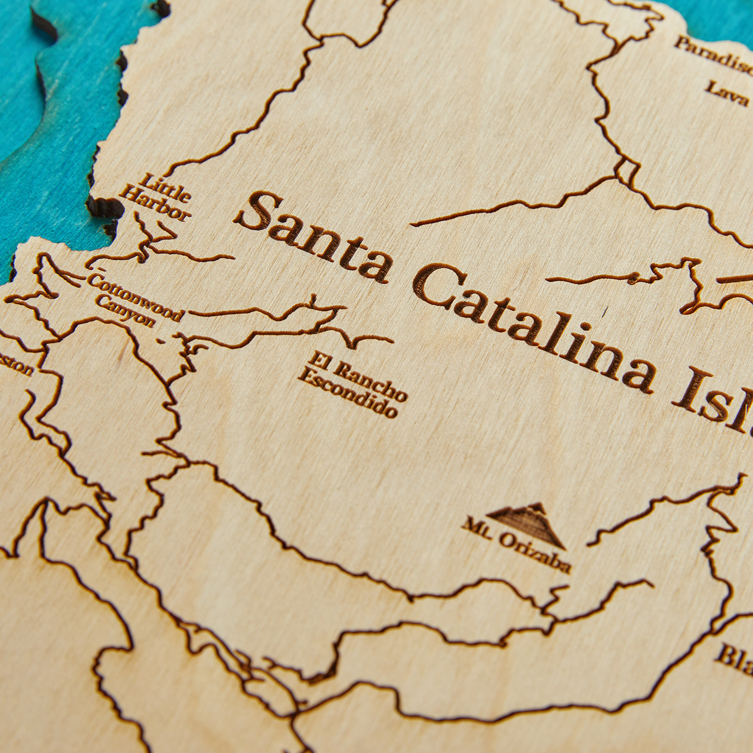
Santa Catalina Island
Product Description
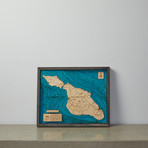
Adding an elevated, rustic aesthetic to your walls with its robust, yet incredibly detailed, layered wood construction, this 3D map of California's Catalina Island will remind you of your favorite locale in classic, craftsman-inspired style.
Part of the California archipelago known as the Channel Islands, Catalina Island is a rocky island in the Gulf of Santa Catalina, about 22 miles south-southwest of Los Angeles. Native Americans tribes, who referred to themselves as Pimugnans or Pimuvit, settled the island over 8,000 years,
ago, before it was claimed by Spain in 1542. It’s location was perfect for the operations of fur traders and pirates alike up until the mid-19th century when the land started to be sold as a tourist attraction. Eventually, William Wrigley of the Wrigley Gum fortune purchased the island and developed it as a popular destination getaway for the Hollywood’s rich and famous. Featuring everything from the highest point on the island, 2,097 feet tall Mt. Orizaba, to a range of natural and historical landmarks, this work of art brings the beauty of this incredible destination to your decor.
Product Details
- ColorsEbony, Natural Birch, Turquoise
- Materials
Baltic Birch, Poplar
- Measurements
20"L x 15.5"W x 2"H
- OriginUnited States
— 3D Map Of Santa Catalina Island
— Intricately Carved With To-Scale Details
— Hand Assembled From Layered Baltic Birch + Poplar Wood
— Framed
— Hanging Hardware Included
Shipping Information
-
Shipping AvailabilityCanada, United States
-
Shipping PolicyStandard Ground Shipping
-
Ship In5-7 weeks ⓘ
-
Return PolicyFinal sale, not eligible for return or cancellation


Size Chart